Pin Code 413006 - Solapur, Maharashtra
| Primary City | Solapur |
| Area of Pin Code 413006 | 80.7 km² |
| Population | 133,356 |
| Male Population | 68,351 (51.3%) |
| Female Population | 65,005 (48.7%) |
| Population change from 1975 to 2020 | +418.6% |
| Population change from 2000 to 2020 | +4.8% |
| Median Age | 26.5 years |
| Male Median Age | 25.5 years |
| Female Median Age | 27.5 years |
| Area Codes | 217 |
| Neighborhoods | Bapuji Nagar, Jawaharlal Housing Society, Indira Nagar, Kamgar Vasahat, MIDC, New Paccha peth, Sakhar Peth, Nilam Sramjivi Nagar, Sangameshwar Nagar |
| Timezone | India Standard Time |
| Coordinates | 17.65128765357797° / 75.99064189565965° |
| Related Pin Codes | 412806, 413001, 413002, 413003, 413004, 413005, 413007, 413008, 413106, 413107 |
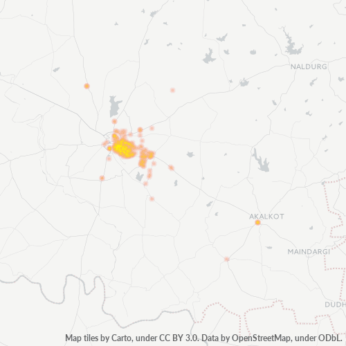
Map of Pin Code 413006 - Solapur, Maharashtra
Interactive Map
Pin Code 413006 - Solapur, Maharashtra Population
Years 1975 to 2030
| Data | 1975 | 1990 | 2000 | 2015 | 2020 | 2025* | 2030* |
|---|---|---|---|---|---|---|---|
| Population | 25,716 | 103,620 | 127,239 | 143,098 | 133,356 | 133,804 | 139,127 |
| Population Density | 318.5 / km² | 1,283.3 / km² | 1,575.8 / km² | 1,772.2 / km² | 1,651.5 / km² | 1,657.1 / km² | 1,723 / km² |
Pin Code 413006 - Solapur, Maharashtra Population change from 2000 to 2020
Increase of 4.8% from year 2000 to 2020
| Location | Change since 1975 | Change since 1990 | Change since 2000 |
|---|---|---|---|
| Pin Code 413006 - Solapur, Maharashtra | +418.6% | +28.7% | +4.8% |
| Solāpur | +80.3% | +27.9% | +12.4% |
| Maharashtra | +107.8% | +52.3% | +27.9% |
| India | — | — | — |
Pin Code 413006 - Solapur, Maharashtra Median Age
Median Age: 26.5 years
| Location | Median Age | Median Age (Female) | Median Age (Male) |
|---|---|---|---|
| Pin Code 413006 - Solapur, Maharashtra | 26.5 yrs | 27.5 yrs | 25.5 yrs |
| Solāpur | 26.5 yrs | 27.5 yrs | 25.5 yrs |
| Maharashtra | 27.2 yrs | 27.8 yrs | 26.6 yrs |
| India | 24.9 yrs | 25.4 yrs | 24.5 yrs |
Pin Code 413006 Population Density
Population Density: 1,652 / km²
| Location | Population | Area | Density |
|---|---|---|---|
| Pin Code 413006 | 133,356 | 80.7 km² | 1,652 / km² |
| Solapur | 1 million | 96.1 km² | 10,736 / km² |
| Maharashtra | 126.5 million | 307,683.7 km² | 411 / km² |
| India | 1,307 million | 3,083,563.4 km² | 424 / km² |
Pin Code 413006 - Solapur, Maharashtra Historical and Projected Population
Estimated Population from 0 to 2100
- JRC (European Commission's Joint Research Centre) work on the GHS built-up grid
- CIESIN (Center for International Earth Science Information Network)
- [Link] Klein Goldewijk, K., Beusen, A., Doelman, J., and Stehfest, E.: Anthropogenic land use estimates for the Holocene – HYDE 3.2, Earth Syst. Sci. Data, 9, 927–953, https://doi.org/10.5194/essd-9-927-2017, 2017.
Neighborhoods
Business Distribution by neighborhood in Pin Code 413006 - Solapur, Maharashtra
Area Codes
Percentage Area Codes used by businesses in Pin Code 413006 - Solapur, Maharashtra
Industries
Business Distribution by Industry in Pin Code 413006 - Solapur, Maharashtra
| Industry Description | Number of Establishments |
|---|---|
| Clothing stores | 345 |
| Corporate management | 123 |
| Education | 140 |
| Electronics stores | 132 |
| Grocery stores and supermarkets | 340 |
| Hindu temple | 131 |
| Repair other | 126 |
| Restaurants | 188 |
| Retail of textiles | 156 |
| Shopping | 383 |
| Shopping other | 261 |
Human Development Index (HDI)
Statistic composite index of life expectancy, education, and per capita income.
Pin Code 413006 - Solapur, Maharashtra Gross Domestic Product (GDP)
GDP per capita, PPP (constant 2017 international $)
| Data | 1990 | 1995 | 2000 | 2005 | 2010 | 2015 | 2020 | 2022 |
|---|---|---|---|---|---|---|---|---|
| GDP per capita | $2,839 | $3,440 | $3,919 | $5,063 | $5,785 | $7,797 | $7,694 | $8,777 |
| Total GDP | $137.1M | $227.5M | $328.8M | $461.5M | $559.4M | $778.7M | $758.3M | $882.3M |
Pin Code 413006 CO2 Emissions
Carbon Dioxide (CO2) Emissions Per Capita in Tonnes Per Year
| Location | CO2 Emissions | CO2 Emissions Per Capita | CO2 Emissions Intensity |
|---|---|---|---|
| Pin Code 413006 | 239,770 tn | 1.8 tn | 2,969.4 tons/km² |
| Solapur | 1,999,104 tn | 1.94 tn | 20,797.2 tons/km² |
| Maharashtra | 216,189,622 tn | 1.71 tn | 702.6 tons/km² |
| India | 1,928,568,344 tn | 1.48 tn | 625.4 tons/km² |
| 2013 CO2 emissions (tonnes/year) | 239,770 tn |
| 2013 CO2 emissions (tonnes/year) per capita | 1.8 tn |
| 2013 CO2 emissions intensity (tonnes/km²/year) | 2,969.4 tons/km² |
Natural Hazards Risk
Relative risk out of 10
| Hazard | Risk Level |
|---|---|
| Drought | High (8) |
Recent Nearby Earthquakes
Magnitude 3.0 and greater
| Date▼ | Time↕ | Magnitude↕ | Distance↕ | Depth↕ | Location↕ | Link |
|---|---|---|---|---|---|---|
| 9/18/11 | 5:52 PM | 4 | 67.7 km | 10,000 m | Maharashtra-Karnataka border region, India | usgs.gov |
| 9/6/07 | 12:09 AM | 3.6 | 73.1 km | 10,000 m | Maharashtra, India | usgs.gov |
| 6/19/00 | 1:22 AM | 4.4 | 66.2 km | 33,000 m | Maharashtra, India | usgs.gov |
| 12/13/95 | 8:09 PM | 4.3 | 79 km | 10,000 m | Maharashtra, India | usgs.gov |
| 11/12/93 | 5:27 AM | 4.6 | 77.4 km | 10,000 m | Maharashtra, India | usgs.gov |
| 10/8/93 | 1:45 PM | 4.7 | 53.2 km | 33,000 m | Maharashtra-Karnataka border region, India | usgs.gov |
| 9/29/93 | 5:53 PM | 4.6 | 74.1 km | 10,000 m | Maharashtra, India | usgs.gov |
| 9/29/93 | 4:10 PM | 5 | 68.2 km | 10,000 m | Maharashtra, India | usgs.gov |
| 9/29/93 | 3:25 PM | 6.2 | 67 km | 6,800 m | Maharashtra, India | usgs.gov |
| 9/29/93 | 7:16 PM | 4.5 | 90.3 km | 10,000 m | Maharashtra, India | usgs.gov |
Primary City
Solapur (IPA: [Sōlāpūr]) ( pronunciation ) is a city located in the south-eastern region of Indian state of Maharashtra. Solapur is located on major road and rail routes between Mumbai and Hyderabad, with a branch line to the cities of Bijapur (now k..
Solapur Wikipedia Page
About Our Data
The data on this page is estimated using a number of publicly available tools and resources. It is provided without warranty, and could contain inaccuracies. Use at your own risk.