Pin Code 501506 - India
India
| Area of Pin Code 501506 | 192.4 km² |
| Population | 65,801 |
| Male Population | 33,731 (51.3%) |
| Female Population | 32,070 (48.7%) |
| Population change from 1975 to 2020 | +622.8% |
| Population change from 2000 to 2020 | +109.4% |
| Median Age | 26.6 years |
| Male Median Age | 26.7 years |
| Female Median Age | 26.4 years |
| Neighborhoods | Hayathnagar, Mahankhali Nagar |
| Timezone | India Standard Time |
| Coordinates | 17.135433035190378° / 78.60348158841786° |
| Related Pin Codes | 501501, 501502, 501503, 501504, 501505, 501507, 501508, 501509, 501510, 501511 |
Map of Pin Code 501506 - India
Interactive Map
Pin Code 501506 - India Population
Years 1975 to 2030
| Data | 1975 | 1990 | 2000 | 2015 | 2020 | 2025* | 2030* |
|---|---|---|---|---|---|---|---|
| Population | 9,103 | 22,307 | 31,420 | 48,367 | 65,801 | 64,731 | 64,691 |
| Population Density | 47.3 / km² | 116 / km² | 163.3 / km² | 251.4 / km² | 342 / km² | 336.5 / km² | 336.3 / km² |
* Projected
Sources: JRC (European Commission's Joint Research Centre) work on the GHS built-up gridPin Code 501506 - India Population change from 2000 to 2020
Increase of 109.4% from year 2000 to 2020
| Location | Change since 1975 | Change since 1990 | Change since 2000 |
|---|---|---|---|
| Pin Code 501506 - India | +622.8% | +195% | +109.4% |
| India | — | — | — |
Sources: JRC (European Commission's Joint Research Centre) work on the GHS built-up grid
Pin Code 501506 - India Median Age
Median Age: 26.6 years
| Location | Median Age | Median Age (Female) | Median Age (Male) |
|---|---|---|---|
| Pin Code 501506 - India | 26.6 yrs | 26.4 yrs | 26.7 yrs |
| India | 24.9 yrs | 25.4 yrs | 24.5 yrs |
Sources: CIESIN (Center for International Earth Science Information Network)
Pin Code 501506 Population Density
Population Density: 342 / km²
| Location | Population | Area | Density |
|---|---|---|---|
| Pin Code 501506 | 65,801 | 192.4 km² | 342 / km² |
| India | 1,307 million | 3,083,563.4 km² | 424 / km² |
Sources: JRC (European Commission's Joint Research Centre) work on the GHS built-up grid
Pin Code 501506 - India Historical and Projected Population
Estimated Population from 0 to 2100
Sources:
- JRC (European Commission's Joint Research Centre) work on the GHS built-up grid
- CIESIN (Center for International Earth Science Information Network)
- [Link] Klein Goldewijk, K., Beusen, A., Doelman, J., and Stehfest, E.: Anthropogenic land use estimates for the Holocene – HYDE 3.2, Earth Syst. Sci. Data, 9, 927–953, https://doi.org/10.5194/essd-9-927-2017, 2017.
Neighborhoods
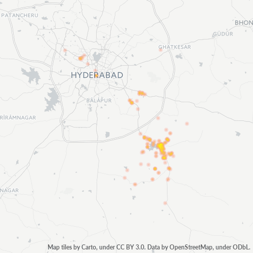
Business Distribution by neighborhood in Pin Code 501506 - India
Business Concentration in Pin Code 501506 - India
Industries
Business Distribution by Industry in Pin Code 501506 - India
| Industry Description | Number of Establishments |
|---|---|
| Apartments | 41 |
| Clothing stores | 59 |
| Education | 71 |
| Electronics stores | 47 |
| Grocery stores and supermarkets | 47 |
| Higher education (colleges and universities) | 41 |
| Hospitals | 58 |
| Other accommodation | 37 |
| Restaurants | 70 |
| Shopping | 151 |
| Shopping other | 63 |
Human Development Index (HDI)
Statistic composite index of life expectancy, education, and per capita income.
Source: [Link] Kummu, M., Taka, M. &Guillaume, J. Gridded global datasets for Gross Domestic Product and Human Development Index over 1990–2015. Sci Data 5, 180004 (2018) doi:10.1038/sdata.2018.4
Pin Code 501506 - India Gross Domestic Product (GDP)
GDP per capita, PPP (constant 2017 international $)
| Data | 1990 | 1995 | 2000 | 2005 | 2010 | 2015 | 2020 | 2022 |
|---|---|---|---|---|---|---|---|---|
| GDP per capita | $2,666 | $2,198 | $2,960 | $5,226 | $7,950 | $11,750 | $14,473 | $16,325 |
| Total GDP | $15.6M | $13.7M | $21.2M | $48M | $93.2M | $164.5M | $223.2M | $258.8M |
Source: [Link] Kummu, M., Kosonen, M. & Masoumzadeh Sayyar, S. Downscaled gridded global dataset for gross domestic product (GDP) per capita PPP over 1990–2022. Sci Data 12, 178 (2025) doi:10.1038/s41597-025-04487-x
Pin Code 501506 CO2 Emissions
Carbon Dioxide (CO2) Emissions Per Capita in Tonnes Per Year
| Location | CO2 Emissions | CO2 Emissions Per Capita | CO2 Emissions Intensity |
|---|---|---|---|
| Pin Code 501506 | 153,421 tn | 2.33 tn | 797.5 tons/km² |
| India | 1,928,568,344 tn | 1.48 tn | 625.4 tons/km² |
Sources: [Link] Moran, D., Kanemoto K; Jiborn, M., Wood, R., Többen, J., and Seto, K.C. (2018) Carbon footprints of 13,000 cities. Environmental Research Letters DOI: 10.1088/1748-9326/aac72a
Pin Code 501506 CO2 Emissions
| 2013 CO2 emissions (tonnes/year) | 153,421 tn |
| 2013 CO2 emissions (tonnes/year) per capita | 2.33 tn |
| 2013 CO2 emissions intensity (tonnes/km²/year) | 797.5 tons/km² |
Natural Hazards Risk
Relative risk out of 10
| Hazard | Risk Level |
|---|---|
| Drought | Medium (5) |
| Flood | Medium (7) |
* Risk, particularly concerning flood or landslide, may not be for the entire area.
About Our Data
The data on this page is estimated using a number of publicly available tools and resources. It is provided without warranty, and could contain inaccuracies. Use at your own risk.