Pin Code 506009 - India
| Area of Pin Code 506009 | 3.436 km² |
| Population | 22,144 |
| Male Population | 11,133 (50.3%) |
| Female Population | 11,011 (49.7%) |
| Population change from 1975 to 2015 | +21.9% |
| Population change from 2000 to 2015 | +6.2% |
| Median Age | 27.7 years |
| Male Median Age | 27.1 years |
| Female Median Age | 28.3 years |
| Neighborhoods | Bank Colony, Bheemaram, Gopalapuram, Hanuman Nagar, Jagruti Colony, Naim Nagar, Kakatiya University, Lashkar Singaram, Naim Nagar, Naim Nagar |
| Timezone | India Standard Time |
| Coordinates | 18.025229723521516° / 79.55549690310558° |
| Related Pin Codes | 506001, 506002, 506003, 506004, 506005, 506006, 506007, 506008, 506011, 506012 |
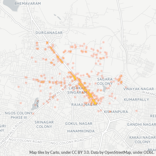
Map of Pin Code 506009 - India
Interactive Map
Pin Code 506009 - India Population
Years 1975 to 2020
| Data | 1975 | 1990 | 2000 | 2015 | 2020 |
|---|---|---|---|---|---|
| Population | 18,167 | 19,708 | 20,849 | 22,144 | 23,424 |
| Population Density | 5,287.1 / km² | 5,735.6 / km² | 6,067.6 / km² | 6,444.5 / km² | 6,817 / km² |
Pin Code 506009 - India Population change from 2000 to 2015
Increase of 6.2% from year 2000 to 2015
| Location | Change since 1975 | Change since 1990 | Change since 2000 |
|---|---|---|---|
| Pin Code 506009 - India | +21.9% | +12.4% | +6.2% |
| India | +111.1% | +50.6% | +24.5% |
Pin Code 506009 - India Median Age
Median Age: 27.7 years
| Location | Median Age | Median Age (Female) | Median Age (Male) |
|---|---|---|---|
| Pin Code 506009 - India | 27.7 yrs | 28.3 yrs | 27.1 yrs |
| India | 24.9 yrs | 25.4 yrs | 24.5 yrs |
Pin Code 506009 Population Density
Population Density: 6,445 / km²
| Location | Population | Area | Density |
|---|---|---|---|
| Pin Code 506009 | 22,144 | 3.436 km² | 6,445 / km² |
| India | 1,307 million | 3,083,563.4 km² | 424 / km² |
Pin Code 506009 - India Historical and Projected Population
Estimated Population from 900 to 2100
- JRC (European Commission's Joint Research Centre) work on the GHS built-up grid
- CIESIN (Center for International Earth Science Information Network)
- [Link] Klein Goldewijk, K., Beusen, A., Doelman, J., and Stehfest, E.: Anthropogenic land use estimates for the Holocene – HYDE 3.2, Earth Syst. Sci. Data, 9, 927–953, https://doi.org/10.5194/essd-9-927-2017, 2017.
Neighborhoods
Business Distribution by neighborhood in Pin Code 506009 - India
Area Codes
Percentage Area Codes used by businesses in Pin Code 506009 - India
Industries
Business Distribution by Industry in Pin Code 506009 - India
| Industry Description | Number of Establishments |
|---|---|
| Apartments | 48 |
| Clothing stores | 49 |
| Education | 74 |
| Electronics stores | 54 |
| Grocery stores and supermarkets | 111 |
| Hardware store | 47 |
| Higher education (colleges and universities) | 77 |
| Other accommodation | 41 |
| Pharmacies and drug stores | 53 |
| Real estate | 40 |
| Restaurants | 98 |
| Shopping | 130 |
| Shopping other | 117 |
| Travel and transportation | 46 |
Human Development Index (HDI)
Statistic composite index of life expectancy, education, and per capita income.
Pin Code 506009 CO2 Emissions
Carbon Dioxide (CO2) Emissions Per Capita in Tonnes Per Year
| Location | CO2 Emissions | CO2 Emissions Per Capita | CO2 Emissions Intensity |
|---|---|---|---|
| Pin Code 506009 | 44,389 tn | 2 tn | 12,918.5 tons/km² |
| India | 1,928,568,344 tn | 1.48 tn | 625.4 tons/km² |
| 2013 CO2 emissions (tonnes/year) | 44,389 tn |
| 2013 CO2 emissions (tonnes/year) per capita | 2 tn |
| 2013 CO2 emissions intensity (tonnes/km²/year) | 12,918.5 tons/km² |
Natural Hazards Risk
Relative risk out of 10
| Hazard | Risk Level |
|---|---|
| Drought | Medium (5) |
| Flood | High (8) |
Cities
Percentage of businesses by city in Pin Code 506009 - India
About Our Data
The data on this page is estimated using a number of publicly available tools and resources. It is provided without warranty, and could contain inaccuracies. Use at your own risk.