Pin Code 711204 - Liluah, West Bengal
| Primary City | Liluah |
| Area of Pin Code 711204 | 5 km² |
| Population | 114,321 |
| Male Population | 59,633 (52.2%) |
| Female Population | 54,688 (47.8%) |
| Population change from 1975 to 2020 | +85.1% |
| Population change from 2000 to 2020 | +18.4% |
| Median Age | 28.1 years |
| Male Median Age | 28.5 years |
| Female Median Age | 27.7 years |
| Associated Cities | Howrah |
| Neighborhoods | Belur Math, Belur Math, Liluah, Belur, Liluah, Bhatta Nagar, Liluah, Liluah, Patuapara, Liluah, Vivekananda Colony, Liluah |
| Timezone | India Standard Time |
| Coordinates | 22.618885690426687° / 88.33085333242921° |
| Related Pin Codes | 711112, 711201, 711202, 711203, 711205, 711206, 711214, 711225, 711226, 711304 |
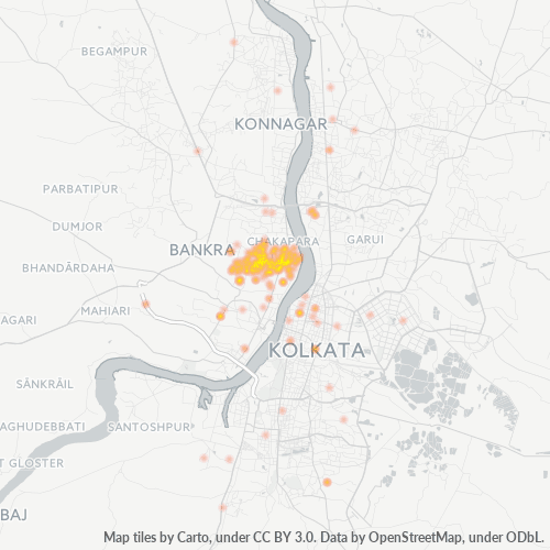
Map of Pin Code 711204 - Liluah, West Bengal
Interactive Map
Pin Code 711204 - Liluah, West Bengal Population
Years 1975 to 2030
| Data | 1975 | 1990 | 2000 | 2015 | 2020 | 2025* | 2030* |
|---|---|---|---|---|---|---|---|
| Population | 61,778 | 80,763 | 96,538 | 112,354 | 114,321 | 120,720 | 133,420 |
| Population Density | 12,335.9 / km² | 16,126.8 / km² | 19,276.7 / km² | 22,434.9 / km² | 22,827.7 / km² | 24,105.4 / km² | 26,641.3 / km² |
Pin Code 711204 - Liluah, West Bengal Population change from 2000 to 2020
Increase of 18.4% from year 2000 to 2020
| Location | Change since 1975 | Change since 1990 | Change since 2000 |
|---|---|---|---|
| Pin Code 711204 - Liluah, West Bengal | +85.1% | +41.6% | +18.4% |
| West Bengal | +94.4% | +44.2% | +22.8% |
| India | — | — | — |
Pin Code 711204 - Liluah, West Bengal Median Age
Median Age: 28.1 years
| Location | Median Age | Median Age (Female) | Median Age (Male) |
|---|---|---|---|
| Pin Code 711204 - Liluah, West Bengal | 28.1 yrs | 27.7 yrs | 28.5 yrs |
| West Bengal | 26.9 yrs | 26.8 yrs | 27 yrs |
| India | 24.9 yrs | 25.4 yrs | 24.5 yrs |
Pin Code 711204 Population Density
Population Density: 22,828 / km²
| Location | Population | Area | Density |
|---|---|---|---|
| Pin Code 711204 | 114,321 | 5 km² | 22,828 / km² |
| West Bengal | 100.7 million | 85,313.5 km² | 1,181 / km² |
| India | 1,307 million | 3,083,563.4 km² | 424 / km² |
Pin Code 711204 - Liluah, West Bengal Historical and Projected Population
Estimated Population from 1700 to 2100
- JRC (European Commission's Joint Research Centre) work on the GHS built-up grid
- CIESIN (Center for International Earth Science Information Network)
- [Link] Klein Goldewijk, K., Beusen, A., Doelman, J., and Stehfest, E.: Anthropogenic land use estimates for the Holocene – HYDE 3.2, Earth Syst. Sci. Data, 9, 927–953, https://doi.org/10.5194/essd-9-927-2017, 2017.
Neighborhoods
Business Distribution by neighborhood in Pin Code 711204 - Liluah, West Bengal
Industries
Business Distribution by Industry in Pin Code 711204 - Liluah, West Bengal
| Industry Description | Number of Establishments |
|---|---|
| Apartments | 141 |
| Clothing stores | 134 |
| Corporate management | 65 |
| Education | 98 |
| Electronics stores | 96 |
| Hindu temple | 69 |
| Pharmacies and drug stores | 71 |
| Real estate | 65 |
| Restaurants | 79 |
| Shopping | 270 |
| Shopping other | 96 |
| Unreachable | 105 |
Human Development Index (HDI)
Statistic composite index of life expectancy, education, and per capita income.
Pin Code 711204 CO2 Emissions
Carbon Dioxide (CO2) Emissions Per Capita in Tonnes Per Year
| Location | CO2 Emissions | CO2 Emissions Per Capita | CO2 Emissions Intensity |
|---|---|---|---|
| Pin Code 711204 | 215,176 tn | 1.88 tn | 42,966.5 tons/km² |
| West Bengal | 145,503,765 tn | 1.44 tn | 1,705.5 tons/km² |
| India | 1,928,568,344 tn | 1.48 tn | 625.4 tons/km² |
| 2013 CO2 emissions (tonnes/year) | 215,176 tn |
| 2013 CO2 emissions (tonnes/year) per capita | 1.88 tn |
| 2013 CO2 emissions intensity (tonnes/km²/year) | 42,966.5 tons/km² |
Natural Hazards Risk
Relative risk out of 10
| Hazard | Risk Level |
|---|---|
| Drought | High (10) |
| Flood | High (10) |
| Earthquake | Medium (4) |
| Cyclone | Medium (5) |
Recent Nearby Earthquakes
Magnitude 3.0 and greater
| Date▼ | Time↕ | Magnitude↕ | Distance↕ | Depth↕ | Location↕ | Link |
|---|---|---|---|---|---|---|
| 8/28/18 | 6:03 AM | 4.5 | 55.8 km | 10,000 m | 8km ENE of Ghatal, India | usgs.gov |
| 8/6/13 | 11:36 AM | 4.5 | 78.3 km | 35,880 m | 7km NNE of Shantipur, India | usgs.gov |
| 6/1/13 | 6:28 AM | 4.1 | 70.8 km | 10,000 m | 11km SSE of Calcutta, India | usgs.gov |
| 1/4/09 | 11:04 PM | 4.2 | 58 km | 35,000 m | India-Bangladesh border region | usgs.gov |
| 4/15/01 | 5:31 PM | 4.3 | 84 km | 10,000 m | Bangladesh | usgs.gov |
| 9/23/96 | 8:28 PM | 4.6 | 84.2 km | 36,400 m | India-Bangladesh border region | usgs.gov |
| 9/28/94 | 9:46 AM | 4.6 | 82.6 km | 33,000 m | India-Bangladesh border region | usgs.gov |
Primary City
Liluah (also spelled Lillooah) (Hindi:लिलुआ, Bengali:লিলুয়া) is a town near Bally municipality in Howrah district, West Bengal, India. It has a railway junction, which is the first station after Howrah station under the Eastern Railway (India) and i..
Liluah Wikipedia Page
Cities
Percentage of businesses by city in Pin Code 711204 - Liluah, West Bengal
About Our Data
The data on this page is estimated using a number of publicly available tools and resources. It is provided without warranty, and could contain inaccuracies. Use at your own risk.