Pin Code 753003 - Bhubaneswar, Odisha
| Primary City | Bhubaneswar |
| Area of Pin Code 753003 | 3.686 km² |
| Population | 70,047 |
| Male Population | 36,303 (51.8%) |
| Female Population | 33,744 (48.2%) |
| Population change from 1975 to 2015 | +37.2% |
| Population change from 2000 to 2015 | +12.2% |
| Median Age | 28.7 years |
| Male Median Age | 28.9 years |
| Female Median Age | 28.4 years |
| Area Codes | 671, 674 |
| Associated Cities | Cuttack |
| Neighborhoods | Gandarpur, Jobra Colony, LIC Colony, Municipal Colony, Ranihat Colony, Ravenshaw University Campus, Shakti Nagar, Shankarpur Colony, Sikharpur |
| Timezone | India Standard Time |
| Coordinates | 20.465832778450388° / 85.89988263683723° |
| Related Pin Codes | 753001, 753002, 753004, 753005, 753006, 753007, 753008, 753009, 753010, 753011 |
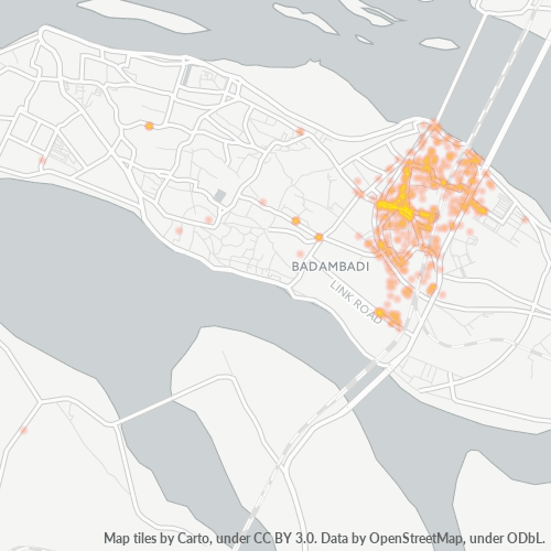
Map of Pin Code 753003 - Bhubaneswar, Odisha
Interactive Map
Pin Code 753003 - Bhubaneswar, Odisha Population
Years 1975 to 2020
| Data | 1975 | 1990 | 2000 | 2015 | 2020 |
|---|---|---|---|---|---|
| Population | 51,071 | 68,683 | 62,446 | 70,047 | 73,536 |
| Population Density | 13,854 / km² | 18,631.6 / km² | 16,939.7 / km² | 19,001.6 / km² | 19,948.1 / km² |
Pin Code 753003 - Bhubaneswar, Odisha Population change from 2000 to 2015
Increase of 12.2% from year 2000 to 2015
| Location | Change since 1975 | Change since 1990 | Change since 2000 |
|---|---|---|---|
| Pin Code 753003 - Bhubaneswar, Odisha | +37.2% | +2% | +12.2% |
| Bhubaneshwar | +143.5% | +60.3% | +26.4% |
| Odisha | +90.7% | +40% | +18.6% |
| India | +111.1% | +50.6% | +24.5% |
Pin Code 753003 - Bhubaneswar, Odisha Median Age
Median Age: 28.7 years
| Location | Median Age | Median Age (Female) | Median Age (Male) |
|---|---|---|---|
| Pin Code 753003 - Bhubaneswar, Odisha | 28.7 yrs | 28.4 yrs | 28.9 yrs |
| Bhubaneshwar | 28.2 yrs | 28 yrs | 28.3 yrs |
| Odisha | 26.6 yrs | 26.6 yrs | 26.6 yrs |
| India | 24.9 yrs | 25.4 yrs | 24.5 yrs |
Pin Code 753003 Population Density
Population Density: 19,002 / km²
| Location | Population | Area | Density |
|---|---|---|---|
| Pin Code 753003 | 70,047 | 3.686 km² | 19,002 / km² |
| Bhubaneswar | 1.1 million | 169.7 km² | 6,405 / km² |
| Odisha | 46.7 million | 155,874.5 km² | 300 / km² |
| India | 1,307 million | 3,083,563.4 km² | 424 / km² |
Pin Code 753003 - Bhubaneswar, Odisha Historical and Projected Population
Estimated Population from 1710 to 2100
- JRC (European Commission's Joint Research Centre) work on the GHS built-up grid
- CIESIN (Center for International Earth Science Information Network)
- [Link] Klein Goldewijk, K., Beusen, A., Doelman, J., and Stehfest, E.: Anthropogenic land use estimates for the Holocene – HYDE 3.2, Earth Syst. Sci. Data, 9, 927–953, https://doi.org/10.5194/essd-9-927-2017, 2017.
Neighborhoods
Business Distribution by neighborhood in Pin Code 753003 - Bhubaneswar, Odisha
Area Codes
Percentage Area Codes used by businesses in Pin Code 753003 - Bhubaneswar, Odisha
Industries
Business Distribution by Industry in Pin Code 753003 - Bhubaneswar, Odisha
| Industry Description | Number of Establishments |
|---|---|
| Cafes | 49 |
| Education | 100 |
| Electronics stores | 75 |
| Grocery stores and supermarkets | 85 |
| Hardware store | 71 |
| Health and medical | 56 |
| Higher education (colleges and universities) | 52 |
| Hindu temple | 58 |
| Hospitals | 52 |
| Other accommodation | 51 |
| Pharmacies and drug stores | 74 |
| Public administration | 50 |
| Religion | 74 |
| Restaurants | 153 |
| Shopping | 218 |
| Shopping other | 88 |
Human Development Index (HDI)
Statistic composite index of life expectancy, education, and per capita income.
Pin Code 753003 CO2 Emissions
Carbon Dioxide (CO2) Emissions Per Capita in Tonnes Per Year
| Location | CO2 Emissions | CO2 Emissions Per Capita | CO2 Emissions Intensity |
|---|---|---|---|
| Pin Code 753003 | 130,363 tn | 1.86 tn | 35,363.6 tons/km² |
| Bhubaneswar | 2,109,814 tn | 1.94 tn | 12,430.7 tons/km² |
| Odisha | 62,086,305 tn | 1.33 tn | 398.3 tons/km² |
| India | 1,928,568,344 tn | 1.48 tn | 625.4 tons/km² |
| 2013 CO2 emissions (tonnes/year) | 130,363 tn |
| 2013 CO2 emissions (tonnes/year) per capita | 1.86 tn |
| 2013 CO2 emissions intensity (tonnes/km²/year) | 35,363.6 tons/km² |
Natural Hazards Risk
Relative risk out of 10
| Hazard | Risk Level |
|---|---|
| Drought | Medium (5) |
| Flood | Medium (4) |
| Cyclone | Medium (5) |
Recent Nearby Earthquakes
Magnitude 3.0 and greater
| Date▼ | Time↕ | Magnitude↕ | Distance↕ | Depth↕ | Location↕ | Link |
|---|---|---|---|---|---|---|
| 1/18/86 | 10:53 PM | 4.4 | 96.4 km | 33,000 m | Orissa, India | usgs.gov |
Primary City
Bhubaneswar, also spelt as Bhubaneshwar /ˌbʊbəˈneɪʃwər/ (Odia: ଭୁବନେଶ୍ୱର), is the capital of the Indian state of Odisha. The city has a history of over 3,000 years starting with the Mahamegha-bahana Chedi dynasty (around the 2nd century BCE) which ha..
Bhubaneswar Wikipedia Page
About Our Data
The data on this page is estimated using a number of publicly available tools and resources. It is provided without warranty, and could contain inaccuracies. Use at your own risk.