Pin Code 759145 - Angul, Odisha
| Primary City | Angul |
| Area of Pin Code 759145 | 58.2 km² |
| Population | 86,620 |
| Male Population | 45,265 (52.3%) |
| Female Population | 41,355 (47.7%) |
| Population change from 1975 to 2020 | -39.0% |
| Population change from 2000 to 2020 | -45.3% |
| Median Age | 26.7 years |
| Male Median Age | 26.9 years |
| Female Median Age | 26.5 years |
| Neighborhoods | Giranga, Hulurisingha, Kulad, Kandsar, Kulad, Kulad Part, Nalco Nagar, National Aluminium Company Ltd |
| Timezone | India Standard Time |
| Coordinates | 20.841790676179986° / 85.15662753014101° |
| Related Pin Codes | 759133, 759134, 759135, 759140, 759141, 759142, 759143, 759146, 759147, 759148 |
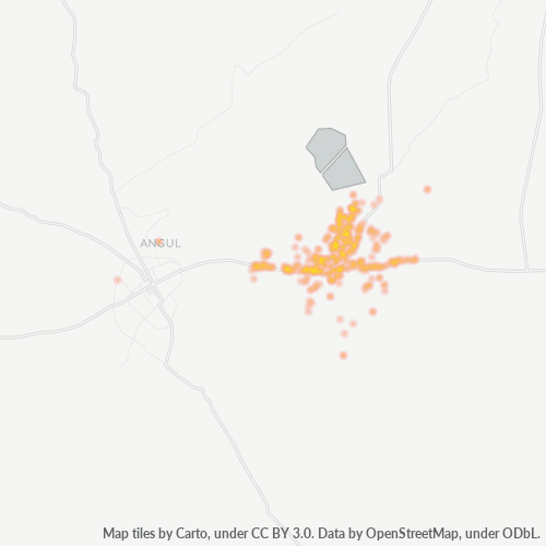
Map of Pin Code 759145 - Angul, Odisha
Interactive Map
Pin Code 759145 - Angul, Odisha Population
Years 1975 to 2030
| Data | 1975 | 1990 | 2000 | 2015 | 2020 | 2025* | 2030* |
|---|---|---|---|---|---|---|---|
| Population | 141,907 | 156,060 | 158,315 | 99,682 | 86,620 | 86,521 | 87,432 |
| Population Density | 2,440.3 / km² | 2,683.7 / km² | 2,722.5 / km² | 1,714.2 / km² | 1,489.6 / km² | 1,487.9 / km² | 1,503.5 / km² |
Pin Code 759145 - Angul, Odisha Population change from 2000 to 2020
Decrease of 45.3% from year 2000 to 2020
| Location | Change since 1975 | Change since 1990 | Change since 2000 |
|---|---|---|---|
| Pin Code 759145 - Angul, Odisha | -39% | -44.5% | -45.3% |
| Angul | -57.7% | -15.6% | -38.2% |
| Odisha | +98.9% | +45.9% | +23.7% |
| India | — | — | — |
Pin Code 759145 - Angul, Odisha Median Age
Median Age: 26.7 years
| Location | Median Age | Median Age (Female) | Median Age (Male) |
|---|---|---|---|
| Pin Code 759145 - Angul, Odisha | 26.7 yrs | 26.5 yrs | 26.9 yrs |
| Angul | 26.7 yrs | 26.5 yrs | 26.9 yrs |
| Odisha | 26.6 yrs | 26.6 yrs | 26.6 yrs |
| India | 24.9 yrs | 25.4 yrs | 24.5 yrs |
Pin Code 759145 Population Density
Population Density: 1,490 / km²
| Location | Population | Area | Density |
|---|---|---|---|
| Pin Code 759145 | 86,620 | 58.2 km² | 1,490 / km² |
| Angul | 22,637 | 7.3 km² | 3,092 / km² |
| Odisha | 46.7 million | 155,874.5 km² | 300 / km² |
| India | 1,307 million | 3,083,563.4 km² | 424 / km² |
Pin Code 759145 - Angul, Odisha Historical and Projected Population
Estimated Population from 0 to 2100
- JRC (European Commission's Joint Research Centre) work on the GHS built-up grid
- CIESIN (Center for International Earth Science Information Network)
- [Link] Klein Goldewijk, K., Beusen, A., Doelman, J., and Stehfest, E.: Anthropogenic land use estimates for the Holocene – HYDE 3.2, Earth Syst. Sci. Data, 9, 927–953, https://doi.org/10.5194/essd-9-927-2017, 2017.
Neighborhoods
Business Distribution by neighborhood in Pin Code 759145 - Angul, Odisha
Area Codes
Percentage Area Codes used by businesses in Pin Code 759145 - Angul, Odisha
Industries
Business Distribution by Industry in Pin Code 759145 - Angul, Odisha
| Industry Description | Number of Establishments |
|---|---|
| Apartments | 21 |
| Car repair | 30 |
| Clothing stores | 25 |
| Department stores | 24 |
| Education | 44 |
| Electronics stores | 42 |
| Grocery stores and supermarkets | 26 |
| Hindu temple | 43 |
| Pharmacies and drug stores | 25 |
| Public administration | 29 |
| Real estate | 29 |
| Religion | 44 |
| Restaurants | 49 |
| Shopping | 113 |
| Travel and transportation | 33 |
Human Development Index (HDI)
Statistic composite index of life expectancy, education, and per capita income.
Pin Code 759145 - Angul, Odisha Gross Domestic Product (GDP)
GDP per capita, PPP (constant 2017 international $)
| Data | 1990 | 1995 | 2000 | 2005 | 2010 | 2015 | 2020 | 2022 |
|---|---|---|---|---|---|---|---|---|
| GDP per capita | $833 | $1,274 | $1,515 | $1,899 | $2,359 | $3,046 | $3,652 | $4,024 |
| Total GDP | $35.2M | $61.2M | $81.9M | $108M | $139M | $184.1M | $217.6M | $241.8M |
Pin Code 759145 CO2 Emissions
Carbon Dioxide (CO2) Emissions Per Capita in Tonnes Per Year
| Location | CO2 Emissions | CO2 Emissions Per Capita | CO2 Emissions Intensity |
|---|---|---|---|
| Pin Code 759145 | 130,540 tn | 1.51 tn | 2,244.8 tons/km² |
| Angul | 33,544 tn | 1.48 tn | 4,581.6 tons/km² |
| Odisha | 62,086,305 tn | 1.33 tn | 398.3 tons/km² |
| India | 1,928,568,344 tn | 1.48 tn | 625.4 tons/km² |
| 2013 CO2 emissions (tonnes/year) | 130,540 tn |
| 2013 CO2 emissions (tonnes/year) per capita | 1.51 tn |
| 2013 CO2 emissions intensity (tonnes/km²/year) | 2,244.8 tons/km² |
Natural Hazards Risk
Relative risk out of 10
| Hazard | Risk Level |
|---|---|
| Drought | Medium (5) |
| Flood | Medium (4) |
Recent Nearby Earthquakes
Magnitude 3.0 and greater
| Date▼ | Time↕ | Magnitude↕ | Distance↕ | Depth↕ | Location↕ | Link |
|---|---|---|---|---|---|---|
| 1/18/86 | 10:53 PM | 4.4 | 17.9 km | 33,000 m | Orissa, India | usgs.gov |
Primary City
Angul (also known as Anugul) pronunciation (Odia: ଅନୁଗୋଳ) is a town and a municipality and the headquarters of Angul district in the state of Odisha, India.
Angul Wikipedia Page
About Our Data
The data on this page is estimated using a number of publicly available tools and resources. It is provided without warranty, and could contain inaccuracies. Use at your own risk.