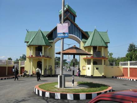
Pin Code 795158 - Imphal, Manipur
Manipur | India
| Primary City | Imphal |
| Population | 223,523 |
| Neighborhoods | Chingamakha, Kakwa, Malom Tulihal, Haobam Marak Lourembam Leikai, Singjamei Top Leikai, Chingamakha |
| Timezone | India Standard Time |
| Coordinates | 24.77781432158505° / 93.93647995487626° |
| Related Pin Codes | 795141, 795142, 795143, 795144, 795145, 795146, 795147, 795148, 795150, 795159 |
Map of Pin Code 795158 - Imphal, Manipur
Interactive Map
Imphal Population Density
Population Density: 7,118 / km²
| Location | Population | Area | Density |
|---|---|---|---|
| Imphal | 251,471 | 35.3 km² | 7,118 / km² |
| Manipur | 3.4 million | 22,308.8 km² | 154 / km² |
| India | 1,307 million | 3,083,563.4 km² | 424 / km² |
Sources: JRC (European Commission's Joint Research Centre) work on the GHS built-up grid
Neighborhoods
Business Distribution by neighborhood in Pin Code 795158 - Imphal, Manipur
Area Codes
Percentage Area Codes used by businesses in Pin Code 795158 - Imphal, Manipur
Industries
Business Distribution by Industry in Pin Code 795158 - Imphal, Manipur
| Industry Description | Number of Establishments |
|---|---|
| Apartments | 7 |
| Education | 10 |
| Electronics stores | 8 |
| Other membership organizations | 7 |
| Restaurants | 8 |
| Shopping | 18 |
| Travel and transportation | 7 |
Imphal CO2 Emissions
Carbon Dioxide (CO2) Emissions Per Capita in Tonnes Per Year
| Location | CO2 Emissions | CO2 Emissions Per Capita | CO2 Emissions Intensity |
|---|---|---|---|
| Imphal | 396,986 tn | 1.58 tn | 11,236.2 tons/km² |
| Manipur | 4,045,923 tn | 1.18 tn | 181.4 tons/km² |
| India | 1,928,568,344 tn | 1.48 tn | 625.4 tons/km² |
Sources: [Link] Moran, D., Kanemoto K; Jiborn, M., Wood, R., Többen, J., and Seto, K.C. (2018) Carbon footprints of 13,000 cities. Environmental Research Letters DOI: 10.1088/1748-9326/aac72a
Imphal CO2 Emissions
| 2013 CO2 emissions (tonnes/year) | 396,986 tn |
| 2013 CO2 emissions (tonnes/year) per capita | 1.58 tn |
| 2013 CO2 emissions intensity (tonnes/km²/year) | 11,236.2 tons/km² |
Recent Nearby Earthquakes
Magnitude 3.0 and greater
| Date▼ | Time↕ | Magnitude↕ | Distance↕ | Depth↕ | Location↕ | Link |
|---|---|---|---|---|---|---|
| 8/17/19 | 11:28 PM | 4.9 | 81.2 km | 66,440 m | 39km SE of Churachandpur, India | usgs.gov |
| 7/13/19 | 8:08 AM | 4.3 | 78.4 km | 71,280 m | 69km ENE of Yairipok, India | usgs.gov |
| 6/4/19 | 6:27 AM | 4.6 | 98.6 km | 65,319 m | 78km SSE of Phek, India | usgs.gov |
| 4/4/19 | 12:45 AM | 5.1 | 88.9 km | 61,780 m | 25km SSW of Phek, India | usgs.gov |
| 3/25/19 | 5:41 AM | 4.6 | 66.9 km | 56,650 m | 16km W of Churachandpur, India | usgs.gov |
| 2/3/19 | 9:20 AM | 4.5 | 28.7 km | 66,280 m | 10km S of Mayang Imphal, India | usgs.gov |
| 1/27/19 | 3:45 PM | 4.7 | 42.4 km | 65,340 m | 9km SSE of Kakching, India | usgs.gov |
| 1/26/19 | 8:49 PM | 4.7 | 37.1 km | 67,970 m | 28km ENE of Yairipok, India | usgs.gov |
| 1/25/19 | 9:07 AM | 4.6 | 52 km | 55,870 m | 21km SSW of Kakching, India | usgs.gov |
| 12/4/18 | 1:44 AM | 4.5 | 93.6 km | 10,000 m | 77km ESE of Yairipok, India | usgs.gov |
Showing 1-10 of 260
…
Source: U.S. Geological Survey (USGS)
Primary City
The city of Imphal (/ˈɪmpəl/, Imphal.ogg ) is the capital of the Indian state of Manipur. The ruins of the Palace of Kangla, the royal seat of the erstwhile Kingdom of Manipur, are in the city centre, surrounded by a moat.
Imphal Wikipedia Page