Postal Code 62320 - Jiutepec, Morelos
| Primary City | Jiutepec |
| Area of Postal Code 62320 | 0.695 km² |
| Population | 6,217 |
| Male Population | 2,924 (47.0%) |
| Female Population | 3,293 (53.0%) |
| Population change from 1975 to 2015 | -1.0% |
| Population change from 2000 to 2015 | -11.4% |
| Median Age | 28.6 years |
| Male Median Age | 27 years |
| Female Median Age | 30.1 years |
| Area Codes | 346, 467, 499 |
| Associated Cities | Cuernavaca |
| Neighborhoods | Antonio Barona |
| Timezone | Central Daylight Time |
| Coordinates | 18.948433944037568° / -99.19495163422208° |
| Related Postal Codes | 62304, 62305, 62306, 62323, 62324, 62325, 62326, 62328, 62329, 62340 |
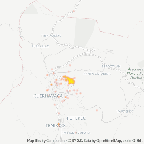
Map of Postal Code 62320 - Jiutepec, Morelos
Interactive Map
Postal Code 62320 - Jiutepec, Morelos Population
Years 1975 to 2020
| Data | 1975 | 1990 | 2000 | 2015 | 2020 |
|---|---|---|---|---|---|
| Population | 6,277 | 6,837 | 7,019 | 6,217 | 6,515 |
| Population Density | 9,027.6 / km² | 9,832.9 / km² | 10,094.7 / km² | 8,941.3 / km² | 9,369.9 / km² |
Postal Code 62320 - Jiutepec, Morelos Population change from 2000 to 2015
Decrease of 11.4% from year 2000 to 2015
| Location | Change since 1975 | Change since 1990 | Change since 2000 |
|---|---|---|---|
| Postal Code 62320 - Jiutepec, Morelos | -1% | -9.1% | -11.4% |
| Jiutepec | +131.1% | +51.4% | +22.4% |
| Morelos | +149.6% | +61% | +27.8% |
| Mexico | +108.7% | +48.4% | +23.5% |
Postal Code 62320 - Jiutepec, Morelos Median Age
Median Age: 28.6 years
| Location | Median Age | Median Age (Female) | Median Age (Male) |
|---|---|---|---|
| Postal Code 62320 - Jiutepec, Morelos | 28.6 yrs | 30.1 yrs | 27 yrs |
| Jiutepec | 27.9 yrs | 29.1 yrs | 26.6 yrs |
| Morelos | 27 yrs | 28.1 yrs | 25.9 yrs |
| Mexico | 26.2 yrs | 27 yrs | 25.3 yrs |
Postal Code 62320 Population Density
Population Density: 8,941 / km²
| Location | Population | Area | Density |
|---|---|---|---|
| Postal Code 62320 | 6,217 | 0.695 km² | 8,941 / km² |
| Jiutepec | 166,982 | 32.2 km² | 5,187 / km² |
| Morelos | 2 million | 4,878.9 km² | 411 / km² |
| Mexico | 126.8 million | 1,965,208 km² | 64.5 / km² |
Postal Code 62320 - Jiutepec, Morelos Historical and Projected Population
Estimated Population from 0 to 2100
- JRC (European Commission's Joint Research Centre) work on the GHS built-up grid
- CIESIN (Center for International Earth Science Information Network)
- [Link] Klein Goldewijk, K., Beusen, A., Doelman, J., and Stehfest, E.: Anthropogenic land use estimates for the Holocene – HYDE 3.2, Earth Syst. Sci. Data, 9, 927–953, https://doi.org/10.5194/essd-9-927-2017, 2017.
Industries
Business Distribution by Industry in Postal Code 62320 - Jiutepec, Morelos
| Industry Description | Number of Establishments |
|---|---|
| All food and beverage | 17 |
| Bakeries | 15 |
| Beauty salons | 29 |
| Cafes | 14 |
| Car repair | 32 |
| Clothing stores | 29 |
| Convenience stores | 42 |
| Education | 20 |
| Gifts, cards and party supplies | 18 |
| Grocery stores and supermarkets | 51 |
| Hardware store | 20 |
| Laundry | 15 |
| Pharmacies and drug stores | 18 |
| Restaurants | 71 |
| Retail of toys and games | 17 |
| Shopping | 73 |
Human Development Index (HDI)
Statistic composite index of life expectancy, education, and per capita income.
Postal Code 62320 CO2 Emissions
Carbon Dioxide (CO2) Emissions Per Capita in Tonnes Per Year
| Location | CO2 Emissions | CO2 Emissions Per Capita | CO2 Emissions Intensity |
|---|---|---|---|
| Postal Code 62320 | 24,524 tn | 3.94 tn | 35,270.1 tons/km² |
| Jiutepec | 705,184 tn | 4.22 tn | 21,904.6 tons/km² |
| Morelos | 8,001,969 tn | 3.99 tn | 1,640.1 tons/km² |
| Mexico | 496,865,013 tn | 3.92 tn | 252.8 tons/km² |
| 2013 CO2 emissions (tonnes/year) | 24,524 tn |
| 2013 CO2 emissions (tonnes/year) per capita | 3.94 tn |
| 2013 CO2 emissions intensity (tonnes/km²/year) | 35,270.1 tons/km² |
Natural Hazards Risk
Relative risk out of 10
| Hazard | Risk Level |
|---|---|
| Drought | Medium (4) |
| Flood | High (8) |
| Earthquake | Medium (4) |
Recent Nearby Earthquakes
Magnitude 3.0 and greater
| Date▼ | Time↕ | Magnitude↕ | Distance↕ | Depth↕ | Location↕ | Link |
|---|---|---|---|---|---|---|
| 7/16/19 | 8:59 PM | 3.1 | 54.8 km | 10,000 m | 2km NW of Ciudad Nezahualcoyotl, Mexico | usgs.gov |
| 9/19/17 | 11:14 AM | 7.1 | 86.6 km | 48,000 m | 1km E of Ayutla, Mexico | usgs.gov |
| 8/27/15 | 6:56 PM | 4 | 93.1 km | 51,700 m | 17km S of Tepecoacuilco de Trujano, Mexico | usgs.gov |
| 12/27/14 | 5:33 AM | 4 | 91.5 km | 55,600 m | 5km N of Teloloapan, Mexico | usgs.gov |
| 6/29/13 | 2:19 PM | 4.5 | 88.6 km | 55,100 m | 14km NNW of Copalillo, Mexico | usgs.gov |
| 6/21/13 | 2:41 AM | 4 | 68 km | 2,000 m | Morelos, Mexico | usgs.gov |
| 6/15/13 | 10:19 PM | 5.8 | 87.8 km | 52,000 m | 15km NW of Copalillo, Mexico | usgs.gov |
| 5/6/13 | 1:33 AM | 4.1 | 59.8 km | 1,000 m | Puebla, Mexico | usgs.gov |
| 2/23/13 | 3:44 AM | 4.1 | 88.1 km | 38,000 m | 14km S of Huitzuco de los Figueroa, Mexico | usgs.gov |
| 7/17/12 | 8:57 AM | 4.1 | 85.2 km | 75,700 m | Guerrero, Mexico | usgs.gov |
Primary City
Jiutepec is a city and its surrounding municipality in the Mexican state of Morelos. It stands at 18°53′N 99°10′W. name Jiutepec comes from the Nahuatl name "Xiutepetl" that means "the precious stones hill". It has tourist attractions like spas. It ..
Jiutepec Wikipedia PageAbout Our Data
The data on this page is estimated using a number of publicly available tools and resources. It is provided without warranty, and could contain inaccuracies. Use at your own risk.