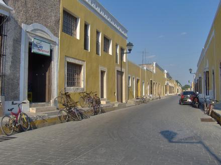
9 Postal Codes in Izamal
View a list of Postal Codes in Izamal| Timezone | Central Standard Time |
| Area | 9.4 km² |
| Population | 17,760 (More Details) |
| Male Population | 8,769 (49.4%) |
| Female Population | 8,991 (50.6%) |
| Median Age | 27.5 |
| Postal Codes | 97540, 97542, 97545 (6 more) |
| Area Codes | 467 |
Interactive Map
9 Postal Codes in Izamal
Izamal Demographic Information
| Population | 17,760 |
| Population Density | 1,888 / km² |
| Male Population | 8,769 (49.4%) |
| Female Population | 8,991 (50.6%) |
| Median Age | 27.5 |
| Male Median Age | 26.7 |
| Female Median Age | 28.2 |
| Businesses in Izamal | 2,271 |
| Population (1975) | 8,820 |
| Population (2000) | 15,274 |
| Population change from 1975 to 2015 | +101.4% |
| Population change from 2000 to 2015 | +16.3% |
Izamal
Izamal (Spanish [isama'l] ) is a small city in the Mexican state of Yucatán, 72 km (about 40 miles) east of state capital Mérida, in southern Mexico. was continuously occupied throughout most of Mesoamerican chronology; in 2000, the city's estimate..
Izamal Wikipedia Page